CHAPTER 5: THE VERIFICATION OF BOUNDARIES
The yellow utility van hadn’t even killed its engine before the driver’s side door swung open.
A tall man in a high-visibility orange vest and a battered khaki cap stepped onto the asphalt, carrying a tripod mounted with a digital total-station laser level over his right shoulder. In his left hand, he held a weathered leather field folder branded with the county seal.
Richard Croft took three rapid steps toward the surveyor, his hand instinctively reaching into his pocket for a card. “Officer, I called the department earlier to report an unregistered obstruction—”
“I’m not an officer, sir. I’m Chief Surveyor Miller with County Parcel Audit,” the man said, his voice flat, dry, and thoroughly unbothered by neighborhood politics. He didn’t shake Richard’s hand. He set the tripod legs onto the street asphalt, loosened the brass thumbscrews, and adjusted the level until the digital bubble centered with a sharp electronic beep.
Mark didn’t move from his position near the severed post. “Work order forty-eight, Chief Surveyor. Priority audit requested for Lot thirty-four, western boundary line.”
Miller glanced at Mark, then down at his digital tablet. “Vance estate. Right. Your father filed for a certified boundary re-verification three years ago, but the fee wasn’t processed until your probate update hit the clerk’s office last Thursday.”
Brenda stepped forward, thrusting her blue binder toward the surveyor’s chest. “We have the official right-of-way schematic right here! ROW four-B was approved by the neighborhood improvement committee—”
Miller didn’t take the binder. He pulled a pair of reading glasses from his vest pocket, hooked them over his ears, and unclasped his own leather folder. “I don’t care what your committee approved, ma’am. The county doesn’t recognize HOA sketchbooks. We recognize deed filings and field monuments.”
He walked straight past Brenda and Richard, stepping onto Mark’s lawn. He didn’t look at the shattered mailbox or the splintered wood. His eyes were glued to the ground as he tracked the exact GPS coordinates displayed on his handheld receiver.
He stopped three feet behind the hedge line, right at the corner where Mark had unearthed the brass pin under the blue slate pavers.
“Monument eight-eight-zero-two,” Miller muttered, kneeling in the grass. He touched the brass cap, then tapped a command into his tablet. “Monuments intact. Grade alignment clear.”
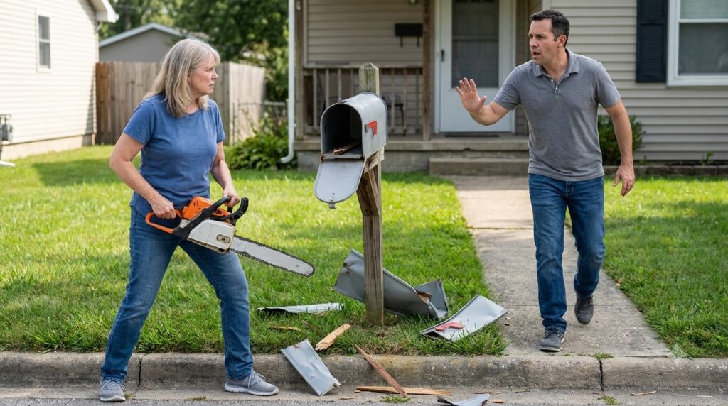
He pulled a spool of neon-pink surveyor’s chalk line from his tool belt, looped it tightly around the brass pin, and walked fifty feet straight toward the curb. He pulled the line taut, snapping it against the grass with a sharp thwack. A vivid pink streak cut through the turf, passing two inches outside the wooden post of Mark’s destroyed mailbox.
“The mailbox post sits four inches inside your deeded property line, Mr. Vance,” Miller declared, standing up and dusting his knees. “Your private boundary extends all the way to the curb line. There is no recorded county easement, utility reservation, or ROW four-B on this parcel.”
Mark felt a cold surge of vindication, but he kept his face completely expressionless. He looked directly at Richard Croft, whose jaw was working silently as his skin turned a mottled, bruised purple.
“You lied to my father for three years,” Mark said softly. “You used a fake utility map to extort two hundred dollars a month out of a dying man.”
“It wasn’t a lie!” Brenda shouted, her voice cracking as the watching neighbors murmured across the street. “The expansion map was drawn up by professional engineers! The commercial developer needed access—”
“What commercial developer?” Miller interrupted, frowning as he flipped a page in his county archive folder. “There’s no commercial development approved for this block. The only municipal filing on record for Oakridge Way involving boundary disputes isn’t about utility expansion at all.”
Miller pulled a yellowed, folded sheet from the back flap of his folder—a thirty-year-old document bearing a red stamp marked MUNICIPAL VARIANCE DENIAL – 1994.
“Lot forty-two,” Miller read aloud, his eyes tracking the old typewriter print. “An unapproved rear garage structure built two feet, four inches past the municipal property boundary into the city fire lane. Subject to mandatory demolition unless a continuous forty-foot access buffer is maintained across adjacent parcels.”
Mark froze. His mind recalculated the entire board game in less than two seconds.
The hand-drawn utility map inside Brenda’s binder wasn’t a corporate land grab. It was a elaborate smoke screen.
Brenda and Richard weren’t trying to sell an easement to a utility company. They were desperately trying to fabricate a fake sixty-foot corridor along the street to satisfy an ancient municipal fire-lane variance—because if the city ever conducted a real boundary audit, their own back garage at number forty-two would be condemned and torn down by the county.
They had destroyed his father’s mailbox—and harassed him for years—not out of greed, but out of absolute, panic-driven self-preservation.
“You built your garage over the city line,” Mark said, the realization settling into a razor-sharp edge. “And you used the entire street as a human shield to cover it up.”
Before Richard could answer, two official vehicles turned the corner of Oakridge Way—a white sheriff’s department patrol car with its lightbar flashing, followed directly by a dark gray government sedan bearing federal license plates.