CHAPTER 4: THE INTERCEPT
“Stay on your side of the apron, Richard.”
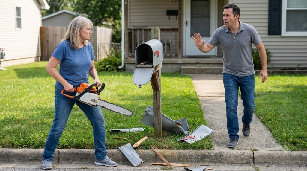
Mark didn’t raise his voice. He stood on the edge of his paved walkway, four feet behind the severed post, his gloved hands relaxed at his sides.
Richard Croft stopped two inches short of the property line. His gray polo shirt was stretched tight over a heavy stomach, his neck flushed a dark, mottled red against his white collar. Beside him, Brenda held the thick blue binder against her ribs like a shield, her knuckles white against the vinyl cover.
“We aren’t here to play juvenile games, Vance,” Richard said. His voice was thick, practiced, conditioned by fifteen years of gaveling down complaints at municipal community centers. “You’re harboring an illegal structure on a designated right-of-way. Brenda executed a lawful abatement after three formal notices went ignored.”
“Show me the county recording,” Mark said.
Richard blinked, his jaw shifting slightly. “The HOA charter—”
“I didn’t ask for the charter,” Mark interrupted, his voice dropping into a cold, flat cadence. “I asked for the county recorder’s plat book and page number establishing ROW 4B as a dedicated public or municipal easement. You have the binder right there, Brenda. Open it.”
Brenda’s eyes darted to her husband before she snapped the binder open. She didn’t flip to an official seal or a county survey document. Instead, she turned to a plastic sleeve protecting a hand-drawn grid map marked with red grease-pencil lines cutting across four separate residential parcels along the curb.
Mark stepped forward, stopping precisely at his deed line. His eyes swept the page in two seconds.
The map wasn’t an official record. It was an internal proposal map drafted on drafting paper, featuring a stamped header from a private civil engineering firm, with four properties highlighted in yellow: his father’s house, number forty, number thirty-eight, and thirty-six. Across all four lots, a shaded six-foot strip was labeled Proposed Private Utility Expansion & Access Corridor ROW-4B.
It wasn’t a public easement. It was an aggressive, unrecorded land grab—a clandestine effort to manufacture an access corridor through private yards to connect the rear cul-de-sac to a commercial utility project planned on the adjacent avenue.
“That’s a draft utility schematic,” Mark said, his eyes rising from the paper to lock onto Brenda’s. “It’s not recorded. It’s not stamped by the county clerk. You’ve been issuing fraudulent fines against my father for three years based on an unapproved private easement proposal.”
Brenda’s chest rose in a sharp, shallow breath. She pulled the binder back against her chest, snapping the cover shut. “The board has broad discretionary authority to prepare infrastructure improvements—”
“The board has zero authority to seize deeded private land or use power tools to destroy federal mail receptacles,” Mark replied.
“You don’t understand how this neighborhood operates, kid,” Richard snapped, stepping half an inch closer, his leather shoe edging over the asphalt lip onto the turf. “Your father knew when to cooperate. If you block this corridor, you’re tying up every property value on this street in administrative litigation for five years.”
“My father paid your fake fines because he was sick and tired of fighting you,” Mark said. He pulled his smartphone from his pocket, holding the screen up so Richard could see the active upload status indicator. “I’m not sick, Richard. And I’m not tired.”
Across the street, three more front doors swung open. Mrs. Gable stepped all the way off her porch, her arms crossed over her apron, accompanied by two neighbors from down the block. A delivery truck pulled over near the curb, its driver leaning out the window to watch the standoff.
Richard’s face tightened as he noticed the gathering eyes. He leaned in, lowering his voice to a harsh whisper. “You think you’re clever because you know how to read a parcel map? You don’t have the survey documentation to back this up in court.”
“I don’t need to wait for court,” Mark said softly. “The county surveyor’s truck just pulled onto Oakridge Way.”
At the end of the block, a yellow utility van equipped with rooftop strobe lights slowed to a halt behind Brenda’s red sedan, its side panel clearly painted in bold black lettering: COUNTY LAND RECORDS & BOUNDARY SURVEY DIVISION.